Not on their posted survey
Do we want housing at Raptor Lane at all?
None of the survey’s posted questions asks it. The two that name Raptor Lane assume homes get built.9
Answer it yourself on Nov. 3.
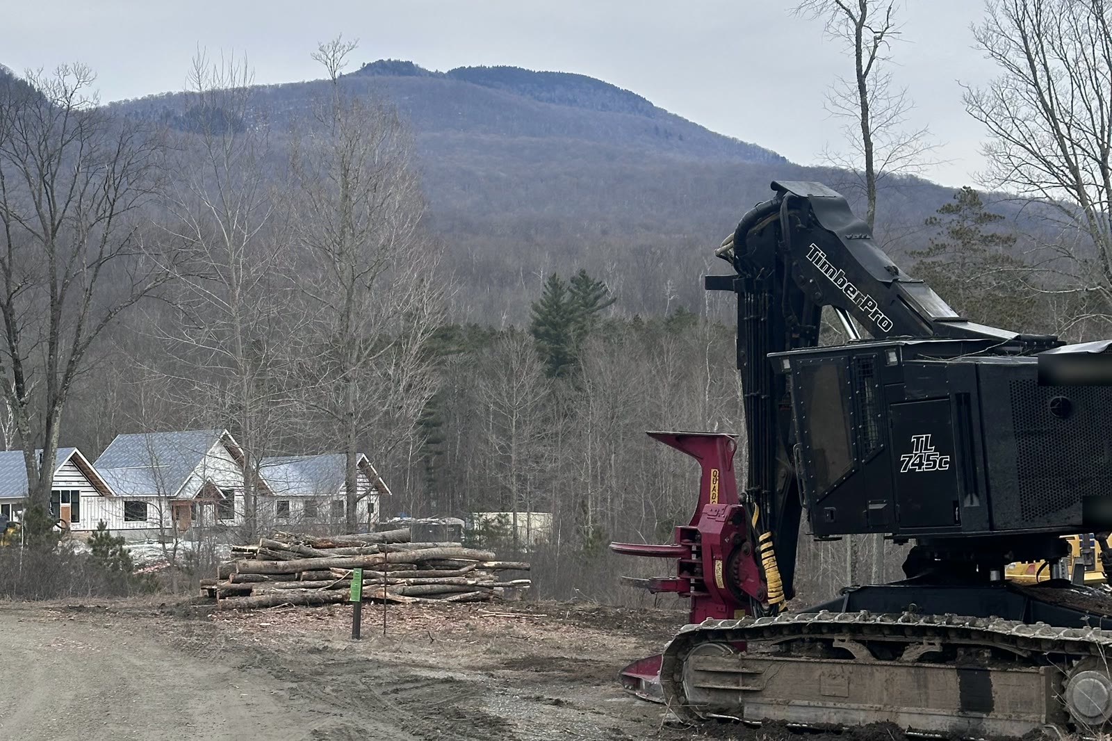
Vote NO on Article 1. Don’t hand over up to 30 acres of Raptor Lane for a plan with no builder, no price and no published water results.
88% of the town’s own survey respondents say their housing is fine. 9
308 acres of town land, nearly 10 miles of public trails.8 In 2025 the town offered part of it to developers for $1. By the town’s count, 60-plus firms were asked. One bid. Plan withdrawn as “too large.”191314 Now Article 1 asks for up to 30 acres first: no committed builder, no price, no published water results, no deed restriction.14
28 days until Election Day. The town’s own timeline: no homes until 2033.2 Ballots are expected in October.
Housing isn’t what Dorset asked for. In the town’s 2019–20 survey, residents’ top three uses for this land were recreation and conservation (trails and parks), energy generation and a town office and community center. Housing came fourth of five.10 Bought in a bargain sale the town itself calls a $1.7 million donation. Nearly 10 miles of public trails, and the Approach trail runs through the housing area. In 2020 the town’s own committee said the upland belongs in the Owls Head Town Forest. It still isn’t.138237 See the trails
60-plus firms asked, by the town’s count. One bid. Plan withdrawn as “too large.” At 35 homes, the town’s own slide: private developers, “None interested… so far.” After a Yes, it would “determine interest and feasibility.”13142 Why not here
Our own Town Plan calls Dorset’s scenic character “an important economic factor” and says public land the town acquires should be “assessed to increase opportunities for ecotourism.”28 Dorset’s inns and restaurants reported about $9.5 million in taxable meals and lodging sales in 2024.39 That’s money spent at local businesses, and the trails and views are part of the draw. The economics
Keep Vermont, Vermont: keep Raptor Lane’s trails in town hands. Vote NO on Nov. 3.
The town’s 2026 housing survey
Dorset Community Housing Survey 2026
22. What do you think is the optimal number of homes for Raptor Lane?
The survey’s only Raptor Lane unit-count question started at 0–30. Other questions in the same survey offered “None.” Most answers still went to the smallest choice.9
“It’s amazing that your lowest choice is 0-30.”
Not on their posted survey
None of the survey’s posted questions asks it. The two that name Raptor Lane assume homes get built.9
Answer it yourself on Nov. 3.
Their slide vs. their survey
Town slide says: “49% expect to move in the next 5–10 years”2 Check their math.
Only 19% said yes.9
Q14: “Would you or someone in your household need to move or like to move to a different home in Dorset in the next 5-10 years?” 339 answers.
What you’re voting on
This is the full text of Article 1, word for word.1
“Shall the voters authorize the conveyance of up to 30 acres (out of the 308-acre parcel) of Town-owned land at Raptor Lane to support the development of up to 35 units of housing?”
If Article 1 fails, the land stays in town hands, and under the petition residents passed in March (Article 13), any sale needs a public vote.22 We’ll bring our own article to conserve the land. See what we’re for
The place
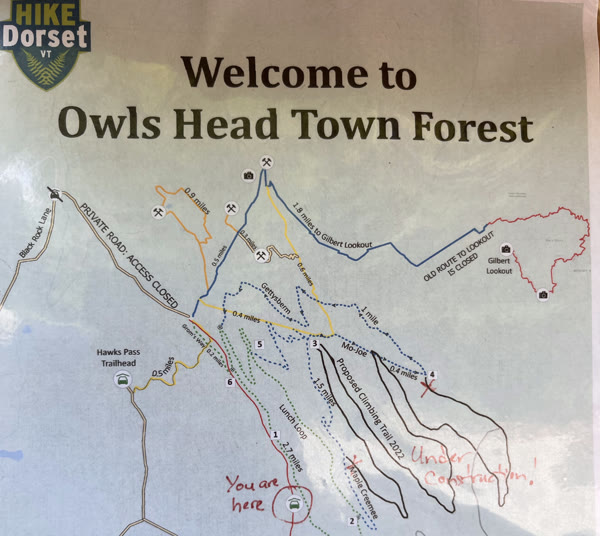
Raptor Lane isn’t waiting for a use. It already has one. Since 2020, volunteers and the town have built nearly ten miles of trails here, on about 166 of the 308 acres, and the town’s Owls Head trailhead is on Raptor Lane.820
These are our trails too.
We hike them. We’ve helped build them, and we still work on them.
The town’s trailhead map, photographed on our visit in July 2022, hand-marked where new trail was under construction.
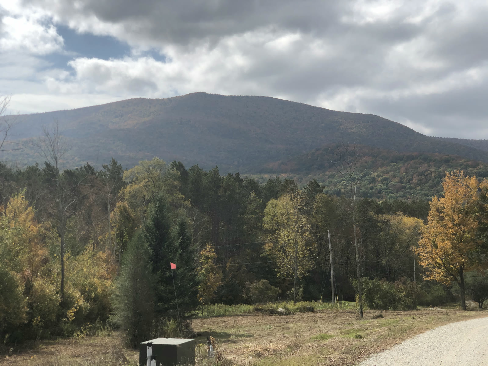
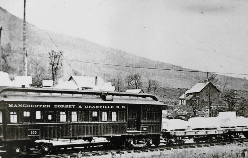
In its 2020 concept for this land, the town’s committee put ballfields, a playground, gardens and trails on roughly the area now drawn for housing.7
The town’s engineers found springs, small streams, and state-significant wetlands with 50-foot buffers in the study area for an earlier, larger layout.5
They also flagged a bear-scarred beech feeding stand uphill of the housing area. They wrote that the state may impose a buffer of a quarter to half a mile around it, that a buffer that size would consume the entire project area
, and that even the smaller buffer means the project cannot avoid impacts
and could face significant Act 250 conditions.5
The town’s Loop concept draws an existing trail and the old gravel road running through the new neighborhood, with the Owls Head trailhead just north.3 On the Trailforks map, that trail is the Approach.23
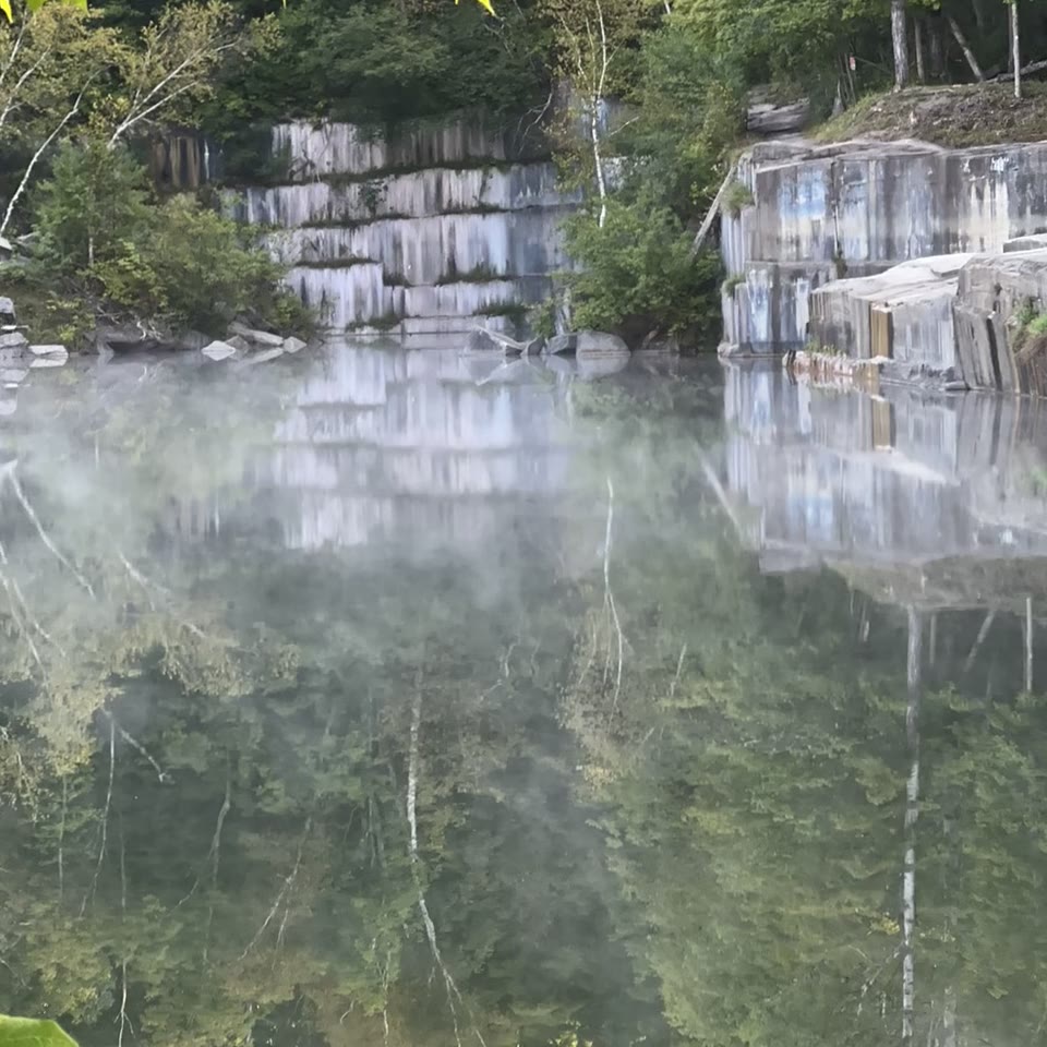
About 98% of the town’s Raptor Lane land drains to the Batten Kill, one of Vermont’s best-known trout rivers; the town’s own stormwater permit sent runoff to its West Branch.721 A small brook that crosses the town land runs through the Dorset Quarry swimming hole on its way there.21
In 2020 the town’s own Raptor Lane committee reached consensus that the upland of this parcel should join the Owls Head Town Forest. Six years later it hasn’t happened; the town’s September slide says only that a portion “likely” would be. We’ve found no conservation easement on the 308 acres. A 2004 state stormwater permit counted 84 acres as conserved, but neither the town’s engineers nor the state can say where they are.725
Why not here
The town couldn’t find a builder at a scale Dorset would accept. It can’t say what the project costs, whether there’s water, or where the septic effluent ends up. Its own study counts a 45-minute drive as Dorset demand. Here’s the record.
It was pulled because it doesn’t work here. A suburban subdivision doesn’t pencil out on this land, and it doesn’t fit the zoning.
In 2025 the town offered this land to developers for one dollar, plus up to $2 million for roads and utilities and up to $250,000 toward pre-development. The town says it asked more than 60 firms. One bid, for about 125 units. In January the town withdrew its own RFP: “the scope of the project is too large.”
Big enough for a private developer is too big for Dorset. Small enough for Dorset, and so far no private developer is interested. That’s not a unit-count problem. It’s the wrong site.
The town wants the vote “prior to design/permitting to avoid risk to partners/project.” After a Yes, it would “determine interest and feasibility of a project.” The engineers’ water-source report went to the Select Board in August and hasn’t been posted; next steps are paused “until after the Town vote.”
The same slide says “Avoid risk to taxpayers.” Any vote on the tax cost can be folded into the annual budget, and nothing says it comes before the land is conveyed. Who’s protecting the taxpayers?
All 15 buildings in the town’s Loop concept sit within about 1,400 feet of the brook that feeds the Dorset Quarry swimming hole, and 11 of them within 1,200 feet.42
~690 ftclosest building to the brook (our analysis)42
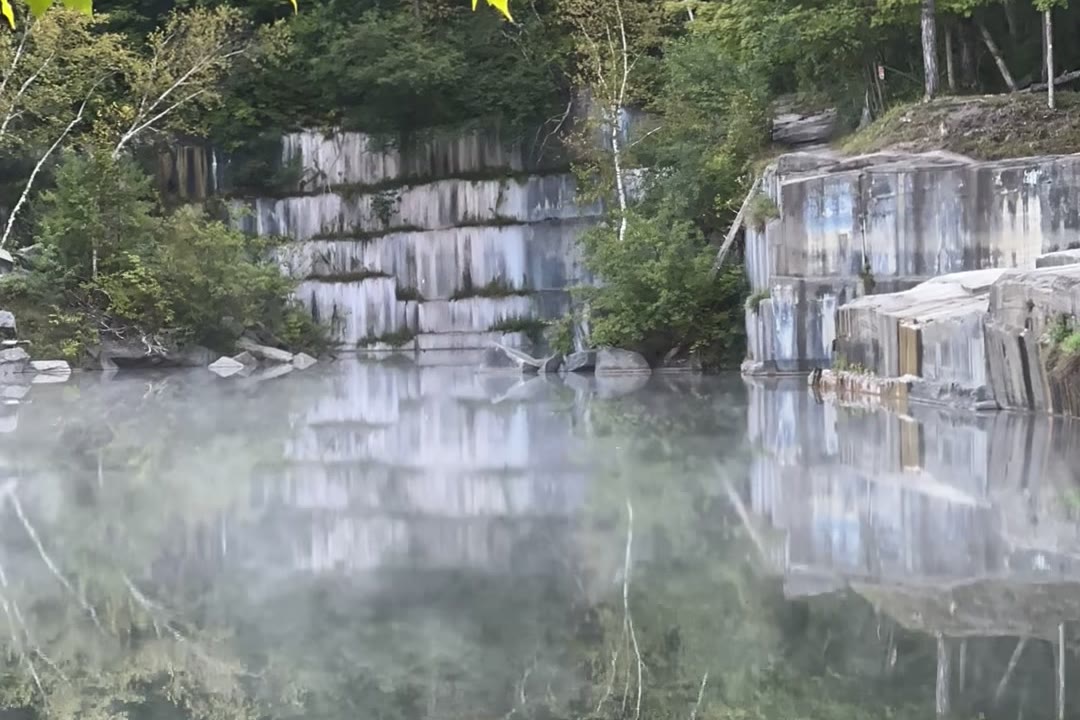
That brook runs through the Raptor Lane town land.21
The town’s engineers planned mound septic systems, needed because of “shallow bedrock and/or groundwater,” and the bedrock is mapped as marble and dolostone across the whole property, the kind of rock the quarry was cut from.5 USGS says karst aquifers, which form in limestone and marble, are “extremely vulnerable to contamination.”40 The town’s hydrogeologist wrote that exact effluent flow paths from one main septic area “can only be determined” after design, and no published study has looked at the quarry. The town wants the land first.5
In the town’s consultant’s model, a 950-square-foot cottage costs $645,350 to build and sells for $490,000.6
−$155,350per cottage, in the town’s consultant’s model6
Every type of home it modeled building loses money at middle-income prices, before any grant or subsidy. Its 30-unit scenario comes out ahead only because ten of its 30 units are bare lots sold at $300,000 each. The consultant warns a lower-density project “may prove insufficient” to cover its roads, water and septic through the state’s CHIP tax-increment program.
The town’s study gets its 50-to-100-homes-a-year figure from a pool of households stretching from Poultney to Bennington to Ludlow.6
~4 a yearwhat Dorset has built: about 38 building permits in a decade41
Dorset has built about four a year.41 The 50-to-100 figure isn’t Dorset demand. It’s a regional pool of about 5,575 households a year, from Poultney to Bennington to Ludlow, times a Dorset “capture rate” the report never discloses. In the study’s own table, two-thirds of that pool sits under $1,250 a month; the cheapest thing the study models at Raptor Lane rents for $1,900.
On Sept. 22, eight active Dorset listings were homes under $600,000, and every one of them is bigger than the town’s model cottage: $490,000 for 950 square feet, ready around 2033.3762
41for-sale results in Dorset on Zillow, Sept. 2236
On Sept. 22, Zillow showed 41 for-sale results in Dorset. The cheapest, a 2-bedroom, 1,686-square-foot house, just cut its price by $34,000 to $325,000. The median home for sale has sat on the market about four months (our count of MLS data). There’s no shortage of houses for sale. What the town is short of is a builder.
Our own Town Plan says “the scenic character of the town is an important economic factor,” and that public land the town acquires should be assessed “to increase opportunities for ecotourism.”28
~$9.5Mtaxable meals and lodging sales at Dorset’s inns and restaurants, 202439
You can see it in the numbers. Dorset’s inns and restaurants reported about $9.5 million in taxable meals and lodging sales in 2024,39 and by the town’s count about 60% of the residential grand list is non-homestead property such as second homes.13 People come, buy and spend here for the place.
Dorset won’t be Dorset if we mortgage our natural beauty for subdivision loops.
The new Town Office was planned in 2021 for a fall 2023 move-in. When estimates came in above the $3.6 million bond, it was scaled back. It opened in September 2025, and Dorset is paying for it until 2053. And on July 29, the same afternoon the Select Board sent Raptor Lane to the ballot, the town manager reported that the FY2025 audit must be restated for a revenue error and that the FY2026 budget, the year just ended, was expected to come in “over by a good amount.”
Before the town takes on a multi-year housing project with no cost estimate, voters deserve the numbers first.
Dorset’s own Town Plan says: “Direct development to historic village centers…”28
The town says its “Loop” concept guides this article. The architects’ own July 30 table lists the Loop at 37–41 units, and all three concepts sketch about ten possible single-family lots that aren’t counted in the unit totals.3
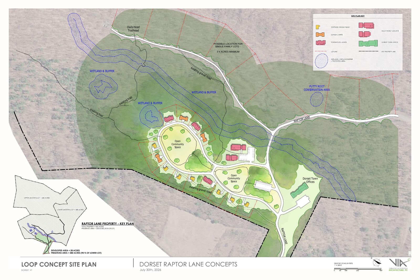 (opens the town’s concept PDF, page 9)
What we’re for
Keep Raptor Lane’s 10 miles of trails, the Owls Head trailhead and the woods above the quarry public, and put the conservation easement the town’s own committee recommended in 2020 on them.
Our Town Plan says it plainly: “Direct development to historic village centers.”28 Raptor Lane isn’t one. It has no public water or sewer, and the town’s engineers say its multi-family buildings would need a zoning change.5 Build where the Town Plan says to build.
How we got here
From a bargain-sale purchase to a November ballot question.
The town buys the 308-acre Raptor Lane parcel for $100,000, against a $1.875 million appraisal.724
Master plan ranks town offices, then green space and recreation, then housing. The committee recommends adding the upland to the Town Forest.7 Trail building begins.8
Voters approve a $3.6 million bond for a new town office on the land, 177–126.2511 It opens in September 2025.26
The town asks developers for qualifications, offering the land for $1 plus up to $2.25 million in town help.15
One proposal arrives: about 125 units.19
After residents object, the Select Board withdraws the plan as “too large.”14
At Town Meeting, residents pass their own petition (Article 13) requiring a public vote before any Raptor Lane land is sold, leased or otherwise disposed of; a separate article sets Australian ballot for those votes.22
Architects present three concepts of 37–58 units. The Select Board warns Article 1: up to 30 acres, up to 35 units.31
You are here.
Ballots expected in the mail. In recent general elections, nearly two-thirds of Dorset ballots were cast early.
Required public hearing on Article 1, 6 p.m., Town Office.1
Vote No on Article 1. Polls open 7 a.m.–7 p.m. at the Town Office, 200 Raptor Lane.
When the town estimates homes would be ready, if the article passes.2
Straight answers
Every number here comes from a town document or public record, or our own analysis of them, labeled as ours. Sources are at the bottom of the page.
No one knows, and that’s the point. All 15 buildings in the town’s Loop concept sit within about 1,400 feet of the brook that feeds the swimming hole.42 The septic effluent would go into mound systems over marble bedrock,5 the kind that forms karst aquifers, which USGS calls “extremely vulnerable to contamination.”40 No study has traced where the effluent would go or looked at the quarry. Do that study before the land is conveyed, not after.
The article caps it at 35. But the concept the town says guides it is listed at 37–41 units in the architects’ July 30 table, and all three concepts sketch about ten possible single-family lots that aren’t counted in the unit totals. Are they part of the 35?3 The town’s slide says 64% prefer “a housing unit count below 30”; the ballot says up to 35.2 The Loop design and the named partners appear only in the town’s slides, not on the ballot.
Nobody has said. No infrastructure cost estimate exists for 35 homes. The town’s only estimate, a 2025 draft for about 100 units, put the town’s potential contributions at $5.25–7.75 million including the land, with $2–3 million for water alone.16 The town’s own consultant warns a lower-density project “may prove insufficient” to pay for its infrastructure through the state’s CHIP tax-increment program.6 Voters deserve the number before they hand over the land.
It’s the last project the town built on Raptor Lane. It was planned in 2021 for a fall 2023 move-in.31 Estimates came in above the $3.6 million bond, so it was scaled back,18 and it opened in September 2025.26 Dorset owes about $3.36 million of principal4 plus about $2.06 million in interest (as of June 30, 2025) through November 2053.11
Dorset financed the building with a 30-year local bond; we found no outside grant toward the building itself. At about $1,690 per resident, it’s the highest of the comparable Vermont town offices we could document, about 30% above Waitsfield’s (same architect), which, like Moretown’s, was mostly paid for by federal disaster grants.17 That’s why we want Raptor Lane’s costs known up front.
Nearly ten miles of trails run across about 166 of the 308 acres, and the official Owls Head trailhead is on Raptor Lane.820 The Loop concept shows an existing trail and the old road running through the new neighborhood;3 the Trailforks map, overlaid on the plan, puts the Approach trail there.23 The town hasn’t said how much trail would be moved or lost.
Volunteers, most of whom live in Dorset; see Who we are. Most of our money has come from our founding members. Every contribution over $100 appears in our public reports to the Vermont Secretary of State, and contributions aren’t tax-deductible.
See How to vote below.
Read it yourself
Local reporting and commentary, mostly from the Manchester Journal. Some links may be paywalled.
The November article is announced; most survey respondents prefer 30 homes or fewer.
A local developer argues 35 units can’t carry the infrastructure costs.
The consultant’s scenarios rely on lot sales and CHIP financing.
Residents require a public ballot vote before any disposal of the land.
The board withdraws the developer RFP after concerns about scale.
Where it started: a single bidder and a 125-unit plan.
How the trails came to be, and who uses them.
The 2018 bargain-sale purchase.
Statewide coverage of the Town Meeting votes.
Who we are
Friends of Dorset is a volunteer group with one aim for the town’s land at Raptor Lane: keep it public and green, for hiking, biking and quiet woods. That’s why we’re voting No on Article 1, which would authorize conveying up to 30 acres of it for up to 35 housing units.1
We are united in our belief that the Raptor Lane tract of land, owned by the Town of Dorset, VT, should be set aside as green space, for all Dorset residents and visitors alike to enjoy.
This green space would consist of hiking, camping cabins and biking trails suitable for recreational use and allow the public the quiet enjoyment of the surrounding environment and utilize its natural beauty in the form of a town park.
The large mountainous and mostly forested tract of land would be dedicated to inspiring pursuits in nature and responsible conservation of natural land.
Since 2020, nearly 10 miles of mountain-bike trails have been built on about 166 of the 308 acres.8 The town’s Owls Head trailhead is on Raptor Lane.20
In 2020 the town’s own committee recommended adding the parcel’s upland to the Owls Head Town Forest.7 The town’s 2026 slides still say only that a portion of the “Upper Lands” would “likely” be conserved.2 We’ll bring an article to Town Meeting in March 2027 to add the upland and trail lands, under a conservation easement. See the plan.
If you ride these trails, hike Owls Head or just want this land kept public, we need you: write a letter, talk with neighbors, help get the early vote out. Get involved.
Also voting No
Another Dorset group urging a No on Article 1. We agree.
Get involved
In recent general elections, nearly two-thirds of Dorset ballots were cast early.35 A vote in October counts the same as one on November 3.
Ballots come by mail in October.4 Mark NO on Article 1, sign the envelope, and mail it by Oct 27 so it arrives before polls close on Nov 3. Or return it to the Town Clerk’s office by close of business Monday, Nov 2. No ballot by mid-October? Call the Clerk at 802-362-4571 x2.
Tuesday, November 3, 7 a.m.–7 p.m., Dorset Town Office, 200 Raptor Lane. Not registered? Vermont lets you register and vote the same day.
The town’s required public hearing on Article 1 is Tuesday, October 20, at 6 p.m. at the Town Office. Ask your questions on the record.
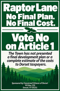
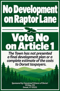
Lawn signs and bumper stickers are free. We deliver and pick up. Private lawns only, with the owner’s OK, at least 25 feet from the Route 30 centerline, never on poles or trees. Every one of our signs comes down Nov 4.
Request a signA community night and fundraiser at the Dorset church, with live music. Free; donations welcome.
A short letter to the Manchester Journal in your own words reaches more neighbors than any ad. What Raptor Lane’s trails and woods mean to your family, or why the town should show its plan before it takes the land. Submit by Oct 9.
We’re paying for signs, postcards and local ads ourselves. Make a check payable to Friends of Dorset, LLC.
Please include your full name, mailing address and town. Contributions are not tax-deductible. Vermont law requires us to report contributors who give more than $100 (name, town and mailing address), and those reports are public. We don’t list donors on this website. Cash gifts are limited to $100, and we can’t accept contributions from foreign nationals.
Vote NO on Article 1. Once the land is conveyed, nothing in Article 1 brings it back. Tuesday, November 3, 7 a.m.–7 p.m., Dorset Town Office, or by mail in October.
Keep Vermont, Vermont.Keep Raptor Lane’s trails public. Vote NO on Nov. 3.